This course builds on existing basic GIS and database knowledge and introduces tools and plugins in QGIS to help with managing large raster and vector datasets.
After a brief introduction to the basics of geodatabases and DB Manager in QGIS, participants will set up a database and import vector data from OpenStreetMap and Ordnance Survey.
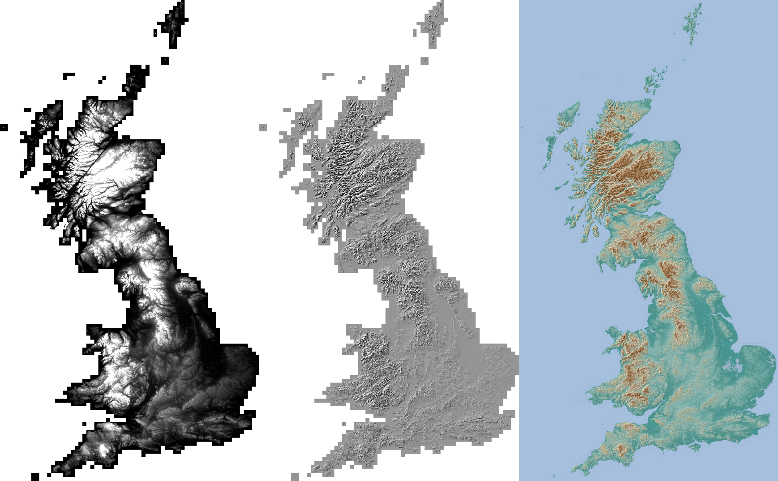
A digital terrain model (DTM) for Great Britain will be generated using GDAL tools and Ordnance Survey's OS Terrain 50 dataset.
GIS users often deal with large volumes of raster or vector data. This training course will help participants learn about the tools and plugins available in QGIS for managing their datasets.
Pre-requisite knowledge and skills
- GIS basics
- Computer terminal / prompt basics
Key Skills
Participants will acquire the following key skills:
- Basics of geodatabases (SpatiaLite and PostGIS)
- Importing and loading various vector datasets into geodatabases
- Handling large raster files with GDAL
Registering for this course
Contact us to register for this course.
Course outline
- Introduction to SpatiaLite
- Create a new database
- Connecting to SpatiaLite in QGIS
- DB Manager
- Tutorial 1: Importing and Styling OpenStreetMap datasets in QGIS
- Introduction to PostGIS
- Installation and configuration
- Connecting to PostGIS database in QGIS
- Tutorial 2: Installing PostGIS
- Tutorial 3: Creating a PostGIS database
- Tutorial 4: Connecting to PostGIS in QGIS
- Tutorial 5: Importing and Styling Ordnance Survey MasterMap and ITN in QGIS
- GDAL
- GDAL Shell
- Virtual raster datasets and overviews
- Useful commands for raster conversion, reprojection and clipping
- Automation and batch processing
- Tutorial 6: Creating a Digital Terrain Model for Great Britain
- Raster data in PostGIS
- Setting up a database
- Importing raster data into PostGIS
- Visualise data in QGIS
- Tutorial 7: Working with PostGIS raster
Tutorials
The course features a series of practical tutorials in which participants carry out exercises, further developing skills learnt during the course.
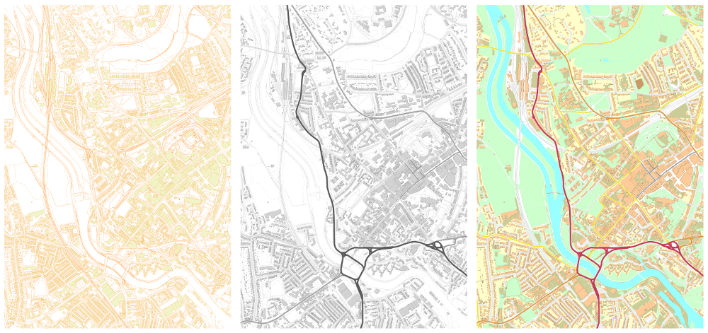
Tutorial 1: Importing and Styling OpenStreetMap datasets in QGIS
Data from OpenStreetMap will be loaded and styled in a SpatiaLite database.
Tutorial 2-5: Installing, configuring and importing data into PostGIS
Participants will install and configure PostGIS. After connecting to the PostGIS database in QGIS, participants then load Ordnance Survey's Integrated Transport Network ™ (ITN) Layer and Topography Layer data (OS MasterMap® ) into PostGIS using the OS Translator II plugin in QGIS and style them accordingly.
Tutorial 6: Creating a Digital Terrain Model for Great Britain
Participants will generate a DTM for Great Britain using 2858 raster tiles from Ordnance Survey's OS Terrain 50 dataset
Tutorial 7: Working with PostGIS raster
Raster data from the previous tutorial will be imported into a PostGIS database. Participants will explore some of the PostGIS raster functions in this tutorial.