Upcoming trainings
- December the 14th 2023 9:00-17:00 CET.
- Where: online remote session
- Language: English
- Cost: 300 Euro
- Lecturers: Radek Pasiok, Martin Dobias
- Max participants: 10 persons (in case we reach max capacity for this training, we will open another training soon)
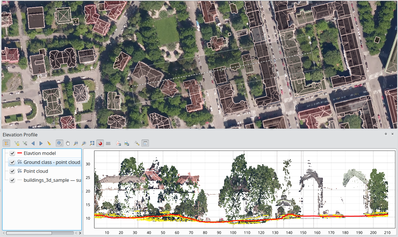
Our Point Cloud Data in QGIS training course is aimed at those who would like to use QGIS to manage and process LiDAR / point cloud data. Attendees will learn how to load various point cloud data formats into QGIS, style and navigate them in 2D and 3D map canvases. QGIS Processing tools are used for data processing, management, filtering and extraction.
Having a basic knowledge of QGIS is recommended before attending this course.
All of our training courses combine presentations with practical exercises, allowing attendees to practice the techniques and concepts being taught. Attendees are supplied with a course manual containing all exercises and presentation materials.
Suitable for those who wish to:
- Load and visualise point cloud data
- Easily navigate point cloud data in both 2D/3D map canvases
- Manage point cloud data (thin, filter, clip, merge and create virtual cloud)
- Use cloud-optimized point clouds (COPC)
- Create QGIS modeller workflows for point clouds
- Create animations in 3D view with point clouds
- Learn tips & tricks to get most out of the point cloud data
Course structure
Our Point cloud in QGIS training course is a 1-day course that covers the following topics:
- Introduction to point clouds
- Categories of point clouds
- File formats - LAS/LAZ/COPC, ZLAS, etc.
- Other point cloud viewers
- Why and when use QGIS to handle point clouds - handling multiple data types
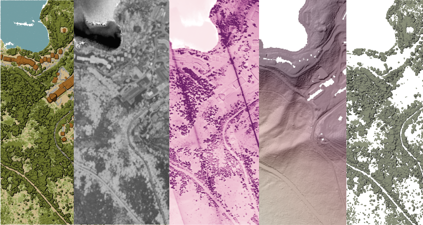
- Point clouds in QGIS
- Loading point cloud data
- Filtering by existing classification or a bounding box
- Styling and global shading
- Identifying
- Creating profiles for point clouds and other data types
- Exporting point clouds to other vector data formats
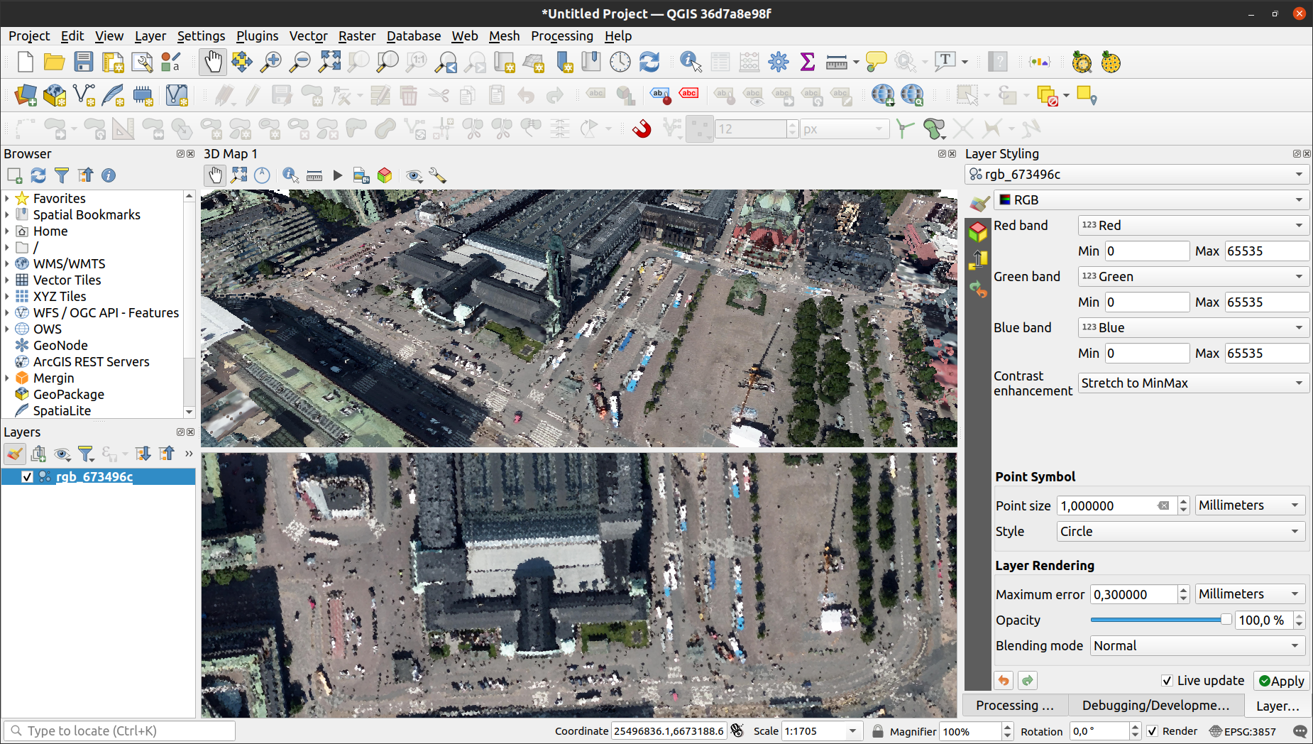
- 3D visualisation QGIS
- Introduction to 3D scenes
- 3D navigation (Google Earth alike)
- 2D/3D views interaction
- Adding layers and configuring elevation for scenes
- Styling points in 3D view - rendering as a surface
- 3D effects - eye-dome, occlusion and shadows
- Measurement and identifying in 3D
- Creating animations
- Point cloud data processing tools
- Conversion tools
- Other point cloud format
- Vector
- Raster
- Management tools
- Assign projection
- Build virtual point cloud
- Clip
- Create cloud-optimised point cloud (COPS)
- Get general information about a point clood dataset
- Merge
- Reproject
- Thin (by sampling radius or skipping points)
- Tile
- Conversion tools
- Using online point clouds services
If you are interested in attending the training please contact us at training@lutraconsulting.co.uk