
Since the addition of Spatio-Temporal Asset Catalog to QGIS last year (see the blogpost), there have been several interests from the QGIS community to include an easier access to Microsoft Planetary Computer (MSPC) datasets. There is also a QGIS plugin but the plugin is no longer maintained and updated.
In response to that, Microsoft has reached out to us to include an easier authentication to the free and open data from Microsoft Planetary STAC datasets. In September 2025, we added this feature to QGIS and now you can easily explore thousands of datasets directly from within QGIS.
Below is a quick summary of how you can work with MSPC data in QGIS.
To add the MSPC data in QGIS, you need to add a new STAC connection. The data catalog link is currently hosted here.
To add a new STAC connection, simply right-click on the STAC icon from the Browser panel and add the link above. In addition, you need to first add MSPC to your Authentication Configuration, by clicking on the green plus sign:
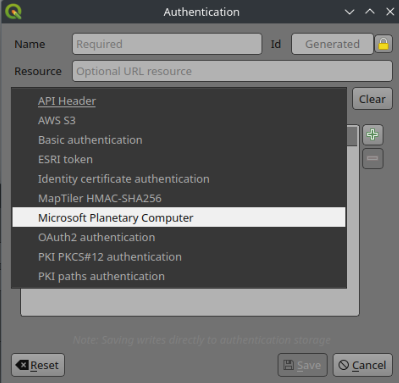
And then you can select it for your connection:

Once the connection is added, you can see the full list of datasets in the Browser panel.
There are millions of items (petabytes of data) within the MSPC catalogue. Browser panel offers you a quick overview of available datasets and items, but when you want to search for a specific time inside a specific region, using the Browser panel is not ideal. For that, you can open the Data Source Manager and use Filtering functionality:
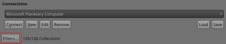
Note that when you first connect to MSPC, it will not show any Collections. You will need to select at least a collection from the Filter dialog in the next section.
This will open a new window, where you can select the spatial extent, time span and dataset:
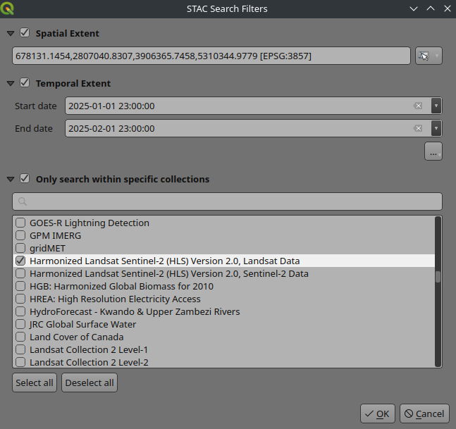
In the example above, we limited the area to somewhere around southern Europe and the time frame to be between first of January and first of February 2025 for Harmonized Landsat Sentinel-2. This will now show the matching results in your Data Source window (including a preview image if available from the catalog). If you enable the dataset footprint, you should be able to also see the bounding box of each dataset:
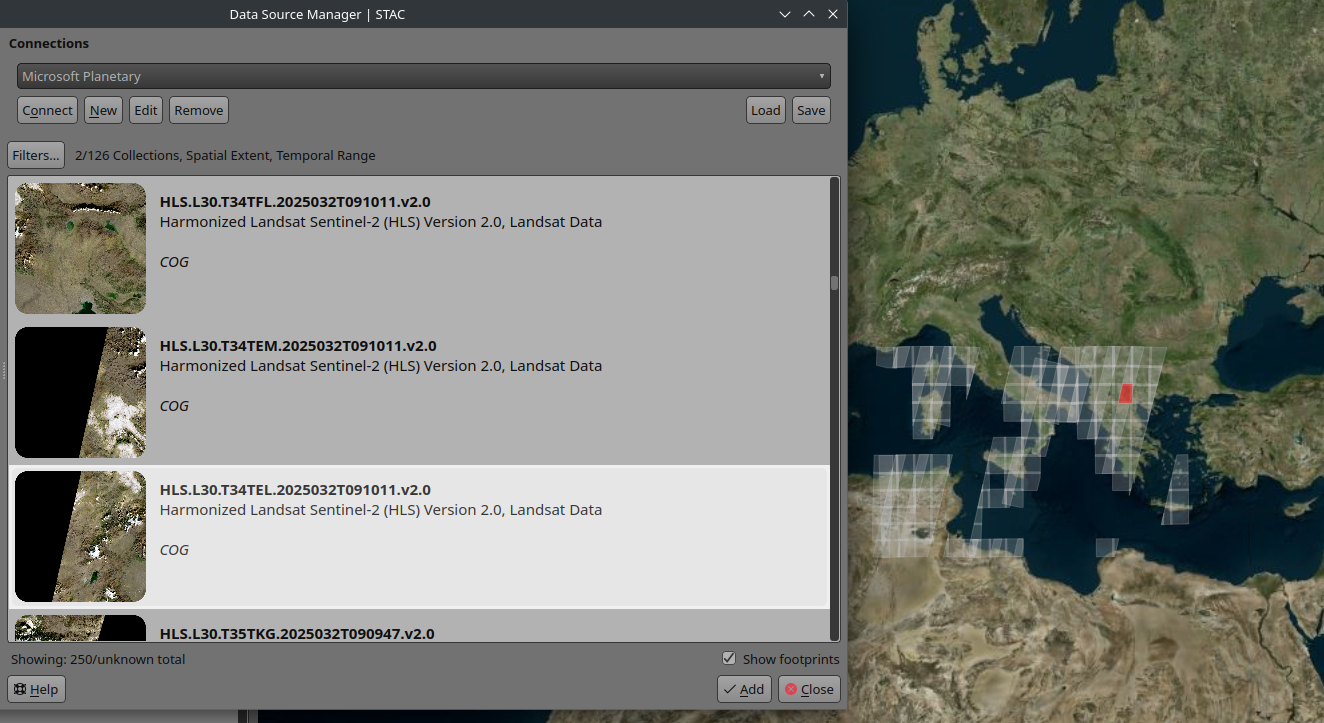
Currently, you can download the dataset and if it is cloud-optimized Geo-Tiff (COG) or point cloud (COPC), you can directly stream the data to your QGIS without downloading the data. There is work under way to support other cloud-optimized formats to be accessed from STAC.
This project was funded by Microsoft. They have also launched a public preview of a MSCP Pro recently. With MSCP Pro, you can publish and share the spatial data ingested to your Azure through STAC standard. This will allow organizations to make their datasets privately accessible. As a part of the new work, we have also added support for MSPC authentication in QGIS. This will allow users to sign in through their Entra ID and access their private data from their internal STAC connection. For more information about MSPC Pro, visit this page.
If you want to see more improvements to STAC integration in QGIS or have new ideas and suggestions, please get in touch.
Let's make the QGIS work for you
Lutra Consulting is a QGIS-focused expert provider of geospatial software development, consulting, training, and support services.


.png)
